Dawson Trail historical map unveiled in East Braintree
Advertisement
Hey there, time traveller!
This article was published 18/09/2020 (1830 days ago), so information in it may no longer be current.
A large map of the historic Dawson Trail was unveiled Sunday at the Midwinter School museum and heritage site in East Braintree, as part of an ongoing effort to develop the tourism potential of the route that linked the Red River Colony to eastern Canada.
Approximately 90 people gathered to watch local historian Lorna Feilberg Annell reveal the 20-foot-long map, which depicts the Manitoba portion of the Dawson Trail and 28 points of interest.
The event punctuated a day of outdoor festivities, organized by the Midwinter Heritage Association, that included site tours, live music, a flea market, silent auction, and steak dinner.
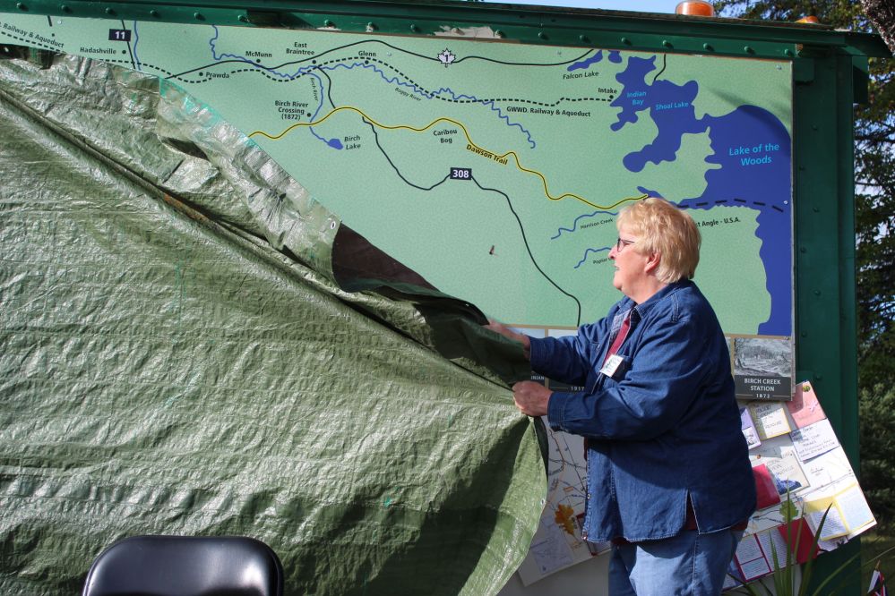
The idea of creating a mural-sized map was pitched to Annell last summer by the Dawson Trail Art and Heritage Committee, which formed last year to gather stories about the Dawson Trail and produce a self-guided interpretive tour consisting of sign boards, walking trails, geocaches, and roadside attractions. A regional art tour is also in the works.
Annell, who published a book on the history of the East Braintree area, contributed information on the portion of the Dawson Trail between the Whitemouth River and Lake of the Woods. She also drew a map square depicting the Hudson’s Bay Company post at Ste Anne.
Signex in Steinbach manufactured the map from a placemat-sized mockup. The pandemic delayed plans to unveil it on Manitoba Day (May 12).
Margaret Feilberg, president of the Midwinter Heritage Association and Annell’s sister, sourced and painted the large storage container on which the map is mounted.
The additional storage space will allow a nearby granary to be converted from a storage shed into an exhibit space for artifacts.
In speeches preceding the unveiling, Feilberg and Annell highlighted historical links between East Braintree and the Dawson Trail. The road’s namesake, Simon James Dawson, passed through the area in the late 1850s as he surveyed the route, Annell said.
Feilberg said the heritage association hopes to one day install a section of ‘corduroy’ log road on the museum grounds to pay tribute to the loggers who built the Dawson Trail.
RM of Reynolds reeve Trudy Turchyn congratulated the volunteers who worked on the map and thanked them for keeping local history alive.
Opened in 1871, the Dawson Trail was the first land connection between Fort William (Thunder Bay) and the Red River Colony. It was used extensively until 1898, when the railway reached Ste Anne.
For more information on the work of the Dawson Trail Art and Heritage Committee, visit dawsontrailtreasures.ca.
-with files from Greg Vandermeulen